What Is an As-Built Survey and When Does Your Project Require One?

Many property owners first hear about an as-built survey at the worst time, right before a closing or a loan sign-off. Knowing what it is and when you need one can save you time, money, and a lot of stress. What Is an As-Built Survey? An as-built survey is done after construction ends. It records […]
What a Land Survey Company Checks on Narrow Lots
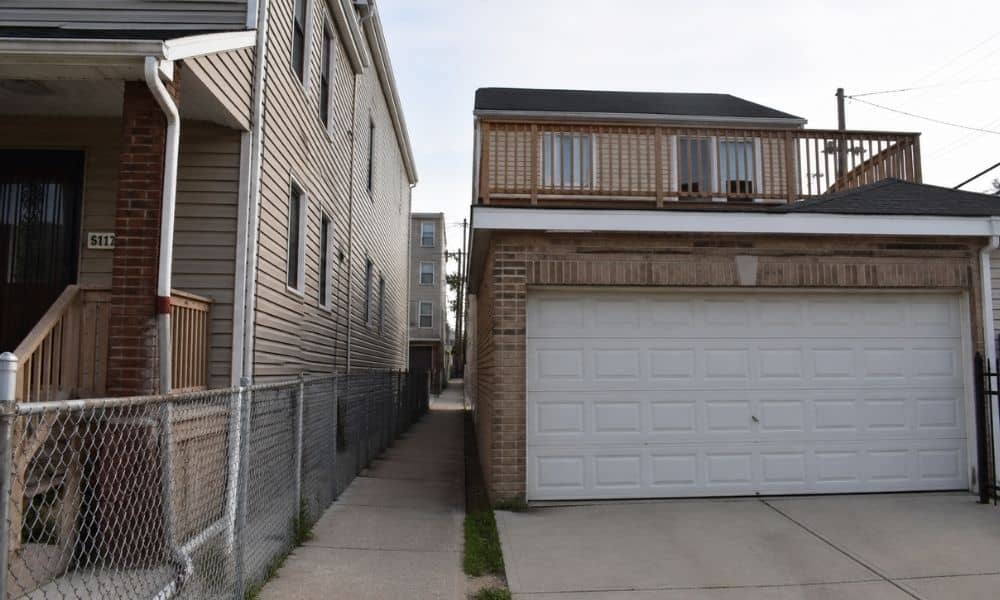
Chicago homes often sit on tight lots. You walk down a slim side path. You park in a garage off the alley. It all feels pretty normal at first. Still, small spaces can hide real problems. That’s where working with a land survey company in Chicago starts to make sense. Instead of just marking lines, […]
Hidden Drainage Problems LiDAR Mapping Can Reveal
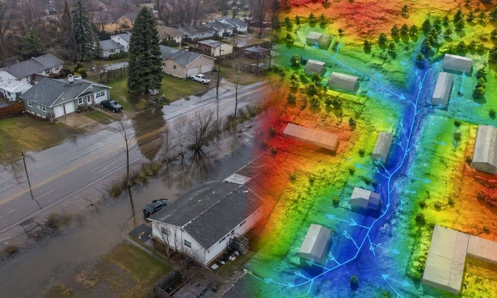
Heavy rain hit the Chicago area again this week. Streets filled up fast. Some homes saw water creep closer than expected. For many people, it felt sudden. But the truth is simple. Most of these problems were already there. Water just exposed them. Many properties in Chicago look flat. They seem safe. You walk the […]