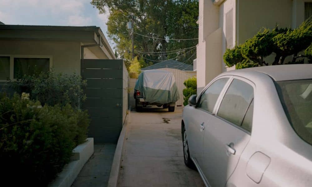
A two-flat can look ready to close until someone asks who gets to park on the concrete pad by the alley. Shared parking comes up often on dense city blocks. Lots are narrow there, and neighbors sometimes split a rear pad under an agreement written decades ago. A loan closing survey shows where that parking sits compared with the property lines. Your lender, title company and attorney then check that picture against the recorded documents that set the parking rights.
How Shared Parking Rights Complicate Residential Loan Closings
Shared parking makes a closing harder because the lender needs to know exactly what the buyer is getting. A parking right can come from a recorded easement, a written agreement between neighbors or an old handshake deal that never reached the county records. Each source carries different weight, and lenders and title companies treat them differently.
A common setup has two neighboring homes sharing one slab off the alley. One owner might hold title to the whole slab while the other holds a recorded right to park on part of it. The title company may list that easement in the title commitment as an item its policy won’t cover. That listing tells the buyer the right exists but doesn’t explain how it works on the ground.
Trouble starts when daily use and the paperwork don’t match. The survey might show the neighbor’s car parked in a spot the records never mention. Questions like that tend to surface late, so it helps to spot them weeks before the closing date.
What a Loan Closing Survey Shows Around Parking Areas
A loan closing survey maps the physical parking features on the lot and shows how they relate to the property lines. Surveyors commonly locate paved pads, curb cuts, garages, fences, gates and painted stall lines. In Illinois, buyers and lenders often call this drawing a plat of survey.
The scope can vary by lender and title company. Some want every improvement shown, and others only need the main structures and lot lines. Ask your lender or attorney what the survey must include before the surveyor goes out.
Recorded easements add another layer. When the title company supplies the documents, a surveyor can draw an easement that has a defined location. People call these plottable easements because they include measurements or a sketch you can place on a map. A vague agreement that only lets a neighbor “park behind the building” gives the surveyor nothing exact to draw, so the survey may note the document without a line.
Matching Recorded Parking Rights to Existing Site Conditions
This step compares what the documents grant with how people park today. Parking habits drift over the years. An easement might cover two spaces on the east half of a pad, yet the neighbors now park three cars across the whole slab.
Physical changes cause gaps too. A past owner may have poured a wider pad or added a fence that cuts through the easement area. Someone may have built a shed right where a parking space should sit. The survey records these features as they exist, which lets your attorney see where reality and the records split apart.
In Cook County, deeds and easements go on record with the Cook County Clerk’s Recordings Division. Your title company pulls those records, and the surveyor works from what it provides. A missing document won’t show up on the survey. That makes a thorough title search just as important as the fieldwork.
When Parking Crosses or Approaches a Property Line
If a parking pad or space crosses the property line, the survey will show it as a possible encroachment. An encroachment means something built or used by one owner sits partly on a neighbor’s land. The survey gives the location and the distance involved. It doesn’t decide who is at fault or what should happen next.
Tight lots make this common. Many lots measure about 25 feet wide, so a pad poured a few inches off can cross the line without anyone noticing. Gates, bollards and parking bumpers can also sit right on the edge.
Near misses matter as well. A pad that stops a few inches short of the line may still mean cars overhang the neighbor’s land when they park. The lender might want a written agreement, a title endorsement or another fix before funding. What it asks for depends on the lender and the title company.
Reviewing Survey Findings Before the Loan Closing
The best time to go over the survey is as soon as it arrives. Early review gives your attorney time to request documents, talk with the seller or reach out to the neighbor. Sit down with the plat and the title commitment side by side.
These questions can help that conversation:
- Does the survey show every parking area the listing or seller described?
- Do any recorded parking easements appear on the drawing with a location?
- Does any pad, space, gate or fence cross or touch a property line?
- Who pays to repair or plow the shared parking area?
- Will the lender or title company need anything extra before closing?
Order the survey early if the property has any shared parking. Confirm with your lender, title company and attorney what they need. Doing that saves the last few days before closing from a scramble.
Frequently Asked Questions
Can a loan closing survey show a shared parking area?
Yes. The surveyor can locate the pad, striping, curb cuts and nearby fences. The drawing then shows how that area sits compared with each lot line.
What if a parking space extends across the property line?
The survey will mark it as a possible encroachment and show how far it reaches. Your attorney and lender then decide what to do. Options might include a written agreement with the neighbor or extra title coverage.
Does a survey prove who has the legal right to use shared parking?
No. The survey shows physical conditions and any easement it can map from the records. The legal meaning of a parking right comes from the recorded documents, and your attorney or title company interprets them.