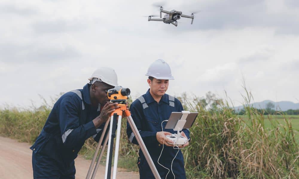
Chicago is changing fast. Empty lots, old buildings, and small open spaces are turning into condos, shops, and offices. For licensed land surveyors, that means more infill projects and tighter job sites to measure. That’s where drone surveying makes a big difference.
Drone surveying gives surveyors a smarter, faster way to collect data on crowded city lots. Instead of setting up tripods and total stations in traffic or narrow alleys, drones can scan rooftops and buildings from above. In a city full of tall structures and small sites, drones aren’t just cool tools — they’re becoming essential for getting accurate measurements and detailed maps.
Why Drone Surveying Matters in Chicago’s New Developments
Chicago’s new zoning rules make it easier to build upward or turn old stores into apartments. These projects often include stacked parcels, rooftop additions, or mixed-use buildings squeezed between others.
Traditional surveying still matters, but drones help fill in what can’t be seen from the ground. They capture rooftops, wall heights, and site details that help everyone — from engineers to developers — plan better.
In fast-growing areas like West Loop, Logan Square, and Wicker Park, drone surveying gives surveyors the clear, complete data needed for smart design and safe construction. It helps turn small, complicated sites into easy-to-understand maps.
Step 1: Preparing for the Flight
Before flying a drone, planning is everything. Start by confirming what kind of survey is needed — is it part of an ALTA/NSPS report for a lender or title company? Does it include air-rights or roof mapping? Knowing this early helps shape your flight plan and the type of data you’ll collect.
Next, check the airspace. Chicago has no-fly zones near O’Hare, Midway, and downtown. Licensed drone pilots under FAA Part 107 must follow these rules and apply for waivers when needed.
Then, pick a safe takeoff spot. In busy neighborhoods, that might be a parking lot, rooftop, or alley. Make sure there are no trees, wires, or moving vehicles nearby.
Good planning means fewer risks — and in city work, that’s the key to smooth flights.
Step 2: Setting Ground Control Points
Once permissions are ready, set up ground control points (GCPs). These are small, visible targets on the ground that help match drone images to real-world coordinates. In Chicago, surveyors usually work with the NAVD88 elevation system and Cook County’s local grid.
Because drones use GPS, tall steel and glass buildings can mess with signals. That’s why surveyors often combine drone data with total station or rover readings. The result is better accuracy — down to just a few centimeters.
Control points connect drone maps to the real world, turning aerial photos into professional-grade surveying data.
Step 3: Capturing the Data
When it’s time to fly, plan your path based on the site’s size and shape. For infill projects, drones should fly lower and slower to capture fine details. Take overlapping photos — about 70% forward and 60% sideways — so the software can stitch them together smoothly.
If the project includes tall buildings or rooftop work, take angled (oblique) photos too. These help create 3D models that show walls, rooflines, and edges clearly.
Drone surveying captures what ground crews can’t — every surface, height, and corner — all in a few quick passes. That saves time and gives everyone a better view of the site before construction starts.
Step 4: Turning Images Into Maps and Models

After the flight, it’s time to process the data. The software combines all the drone photos into orthomosaics (flat, scaled maps) and point clouds (3D models).
This step turns raw images into usable tools for design and analysis. Many old plats still use older coordinate systems, so surveyors must align their drone data carefully to match existing ALTA or boundary surveys.
By merging drone data with total station readings, surveyors can deliver 2D maps, 3D site models, or elevation profiles. These can easily be imported into CAD or BIM programs used by architects and engineers.
Step 5: Sharing Results That Clients Understand
Developers, lenders, and architects don’t always think like surveyors. That’s why showing results visually helps a lot. Drone imagery and 3D renderings make it easy for clients to see what’s happening on-site.
For lenders or title companies, drone maps help confirm improvements and roof details in ALTA/NSPS surveys. For engineers, they provide an accurate base map for grading, drainage, or foundation planning.
Drone surveying isn’t just about collecting data — it’s about presenting it in a way that builds trust and understanding.
Chicago’s City Challenges — and How Drones Help
Working in Chicago means working around tall buildings, narrow streets, and unpredictable weather. Drones make that easier:
- Tight spaces: Launch from alleys or rooftops instead of blocking streets.
- Hard angles: Capture walls and roofs without needing scaffolds or ladders.
- Fast schedules: Get results in hours, not days.
These small advantages make a big difference. For surveyors, drones turn difficult city jobs into smooth, efficient projects.
Drones as a Growth Tool for Survey Firms
Drone surveying isn’t just about new technology — it’s about staying competitive. Offering drone services helps land surveyors stand out to developers who expect quick, detailed, digital results.
By combining traditional ALTA surveys with drone data, surveyors can offer premium “Drone + ALTA Hybrid Packages.” These help clients visualize the project and confirm every measurement with confidence.
For busy developers, that mix of accuracy and speed is exactly what they need. And for surveyors, it’s a smart way to grow business and build long-term partnerships.
Final Thoughts
Drone surveying is changing how Chicago grows. From small infill sites to tall mixed-use buildings, drones give surveyors the detail, accuracy, and flexibility the city demands.
Chicago is building upward — and drone technology helps surveyors keep up. For licensed professionals, mastering drone surveying isn’t just an upgrade. It’s the key to shaping the city’s next skyline safely, efficiently, and confidently.