
When buying or financing commercial property, one of the key steps in protecting both the buyer and the lender is securing title insurance. But title insurance alone isn’t always enough. To make sure that insurance policies cover all possible issues, many professionals rely on ALTA surveys.
These detailed surveys play a critical role in identifying risks, supporting underwriting, and giving a full picture of the property. In cities like Chicago, where property boundaries and land use can be complex, working with trusted ALTA survey services in Chicago IL helps reduce risk and ensure clarity during commercial transactions.
What Title Insurance Covers—and What It Doesn’t
Title insurance protects against problems with a property’s ownership history. This might include unknown liens, errors in public records, or disputes over ownership. But there are limits.
Many title insurance policies have exceptions—items they do not cover. These often include things like boundary and easement documentation, especially when those issues aren’t clearly identified through a current survey.That’s where an ALTA survey becomes important.
How ALTA Surveys Strengthen Title Insurance
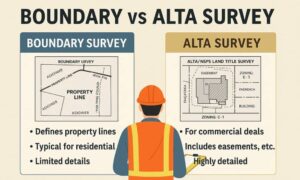
Detailed land title surveys for commercial properties, such as ALTA/NSPS surveys, show more than just boundary lines. They include:
- Easements and rights-of-way
- Building locations and improvements
- Access points and road connections
- Utility lines and visible use restrictions
When title companies review an ALTA survey, they can adjust or remove exceptions on the policy. This means stronger protection for both buyers and lenders. In high-density areas like Chicago, where properties are often close together, these details help prevent future disputes.
Supporting Risk Management for All Parties
ALTA surveys don’t just help the title company—they support risk management across the board. Here’s how:
- For buyers, the survey confirms exactly what is being purchased.
- For lenders, it helps ensure the property is suitable for its intended use and won’t face legal challenges.
- For title insurers, it reduces the chance of future claims by clarifying property conditions at the time of sale.
By catching issues early, ALTA surveys reduce legal and financial risk later.
Table A Items: Adding More Clarity
Table A is a list of optional items that can be added to an ALTA survey. Some examples include:

- Zoning information
- Parking counts
- Flood zone classification
- Utility locations
These extra details are often requested by lenders and insurers to better understand the site. In a city like Chicago IL, where zoning and infrastructure vary by neighborhood, Table A items can offer useful insights during planning and development.
FAQs
1. Can I get title insurance without an ALTA survey?
Yes, but the policy may include more exceptions or offer limited coverage.
2. What risks does an ALTA survey help uncover?
It helps identify access problems, encroachments, easements, and conflicts with the legal description.
3. Does the title company provide the survey?
No. The survey is typically ordered by the buyer or lender, but it’s used by the title company to finalize the policy.
4. How does a survey remove title insurance exceptions?
By showing the true condition of the property, the survey allows insurers to remove or limit standard exceptions.
5. Who reviews the ALTA survey during a transaction?
The title insurer, lender, attorneys, and sometimes zoning consultants or engineers.