Redeveloping property often begins with merging several smaller lots into a single, buildable parcel. However, this is not simply a paperwork task—it requires a thorough legal and technical process. An ALTA Survey plays a crucial role by verifying ownership, aligning physical boundaries with title records, and uncovering potential issues before construction starts. For developers undertaking large-scale urban projects, accurate land assembly supported by an ALTA Survey reduces risk and helps streamline the redevelopment process.
Challenges in Merging Multiple Lots for Redevelopment in Urban Chicago
In older parts of Chicago, merging multiple lots for construction often becomes complicated due to gaps in property records. Many parcels were created decades ago and have changed hands repeatedly. These challenges make lot mergers complex, especially when site conditions no longer match title records.
Common issues include:
- Conflicting legal descriptions between adjacent lots
- Outdated easements or restrictions no longer visible
- Encroachments and informal access paths without documentation
Before design and permitting begin, these problems must be resolved to avoid costly revisions later.
Role of ALTA Survey in Aligning Legal Boundaries for Combined Parcels
The ALTA Survey serves as the link between what’s recorded in the title and what physically exists on-site. Surveyors review deeds, plats, and field conditions to map out a single, unified picture of the assembled land.
This includes:
- Verifying lot lines and dimensions
- Mapping easements, encroachments, and rights-of-way
- Comparing actual site conditions to title commitments
This detailed review ensures all lots connect correctly—legally and physically—before consolidation.
Resolving Conflicts Across Parcel Lines and Shared Infrastructure
Many multi-lot projects reveal conflicts hidden in the gaps between parcels. Shared utility lines, partial building overhangs, and unrecorded access drives often cross lot lines without formal agreements.
An ALTA Survey identifies these risks so they can be resolved early. With survey data in hand, teams can adjust designs, negotiate easement rights, or document shared infrastructure. This reduces legal delays and helps avoid construction stoppages later.
Supporting Title Coordination and Legal Documentation for Lot Consolidation
After the survey confirms field conditions, legal teams rely on title coordination for land development to align title reports accurately. When inconsistencies appear, the ALTA Survey provides evidence to correct legal descriptions, update boundaries, or create new parcel records.
This coordination is essential to:
- Reduce risk in land transfers
- Establish a clean, unified legal boundary
- Support title insurance issuance and lender approval
By verifying every detail before the transaction closes, developers protect the project’s long-term value.
Improving Planning Accuracy for Site Layout and Zoning Compliance

Zoning codes in Chicago require precise site layouts. With verified survey data, design teams can confidently plan for:
- Setback compliance
- Fire access and service routes
- Lot coverage and open space percentages
- Building orientation and utility placement
The survey also supports zoning changes or variance applications by providing accurate data to city reviewers.
Long-Term Benefits of ALTA Survey Integration in Redevelopment Strategy
Once the project is approved and underway, the ALTA Survey remains a useful asset. It helps maintain property records, streamline future expansions, and support clean transactions during resale or subdivision.
Long-term benefits include:
- Reduced legal exposure for future owners
- Smoother permitting in later project phases
- Increased buyer or tenant confidence backed by solid documentation
In a city where land is limited and lot history is complex, survey-supported redevelopment leads to stronger results.
FAQs
1. Why are ALTA Surveys important in lot mergers?
They confirm boundaries, document easements, and align title records reducing legal and planning risk before redevelopment.
2. What problems can they reveal?
Common issues include overlapping lots, mismatched legal descriptions, building encroachments, and unrecorded access points.
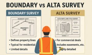
3. Can a basic boundary survey be used instead?
No. Only an ALTA Survey includes title review, legal coordination, and documentation accepted by lenders and attorneys.
4. How do they support zoning compliance?
They ensure site plans follow setback rules, density limits, and circulation requirements before submission to city planning departments.
5. What’s the long-term value of having an ALTA Survey?
It protects future land use, supports resale, and provides documentation for any future audits, expansions, or legal reviews.
